Original-article audit
What this source can support
Reviewed 15 August 2026 · geometry completeness 53/100 · medium-low
All 15 table rows have separate linked published-scale dossiers: nine rock-shelter models and six buried-concrete models. Each correctly fixes the source's reported unit area, while rock excavation, inner concrete, high-mass shells, entries and protection/MEP remain class factors. Krokshallsberget is SEK 215.7m on 1,500 m² / 16,146 ft²; Konstapeln is separately SEK 950.2m on 7,000 m² / 75,347 ft² and is the only unit whose six two-storey side bays and multiple locks are described. The published scales can be held, but geometry confidence remains low and Konstapeln morphology must not be transferred to the other 14 facilities.
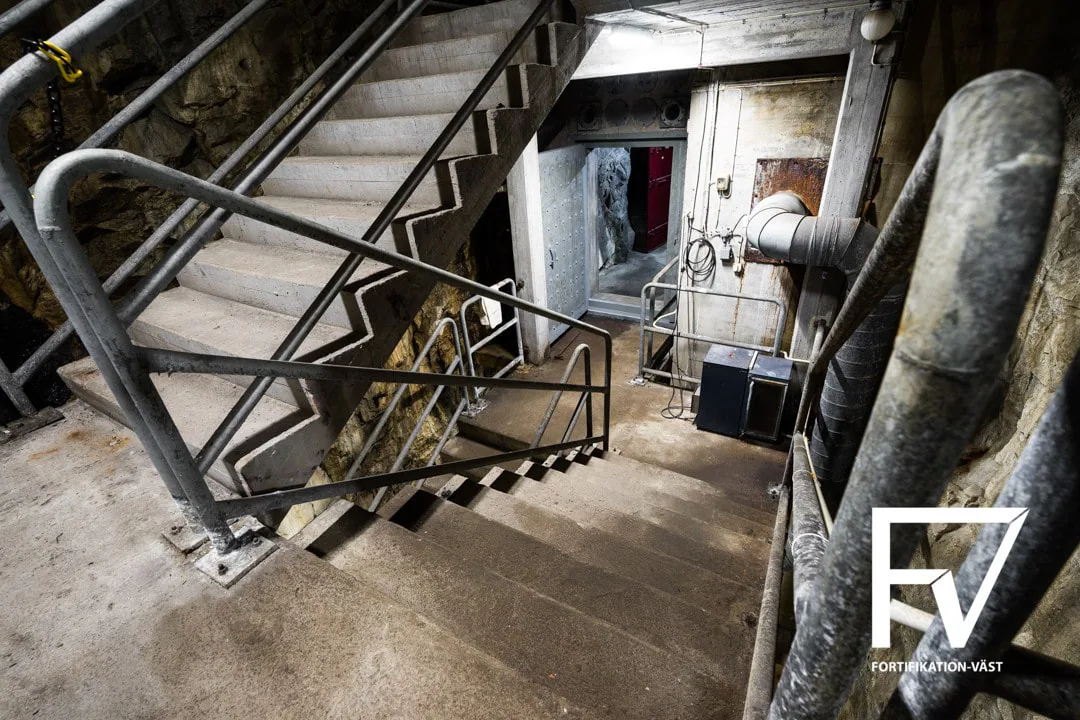
Supported useThe article is a 15-shelter programme history and 1985 schedule, and the complete mapping links one dossier for every table row. Across all 15 large shelters it reports 63,450 m² / 682,970 ft² and 53,896 places; the units comprise nine rock shelters and six reinforced-concrete shelters. Krokshallsberget is 1,500 m² / 16,146 ft²/1,012 places. The detailed morphology—large car-width access tunnels, multiple locks, six two-storey side bays around a circular centre, wells, filtered air and standby generation—belongs only to Konstapeln in Karlskrona, whose table row is 7,000 m² / 75,347 ft² and 2,860 places.
Geometry evidencearea_m2: value: 11600 m² / 124,861 ft² | scope: Katarina, Stockholm | shelter_type: rock | shelter_places: 9638; value: 8000 | scope: Klara, Stockholm | shelter_type: rock | shelter_places: 7209; value: 5000 | scope: Johannes, Stockholm | shelter_type: rock | shelter_places: 5814; value: 4000 | scope: Skravelberget, Stockholm | shelter_type: concrete | shelter_places: 4265; value: 1750 | scope: Haken, Norrköping | shelter_type: concrete | shelter_places: 1182; value: 1000 | scope: Blandaren, Linköping | shelter_type: concrete | shelter_places: 436; value: 7000 | scope: Konstapeln, Karlskrona | shelter_type: rock | shelter_places: 2860 | note: The only facility given a detailed walkthrough.; value: 2000 | scope: Arkaden, Malmö | shelter_type: concrete | shelter_places: 1872; value: 3000 | scope: Domus, Malmö | shelter_type: concrete | shelter_places: 2140; value: 2500 | scope: Kvarnberget, Göteborg | shelter_type: rock | shelter_places: 2193; value: 8000 | scope: Otterhällan, Göteborg | shelter_type: rock | shelter_places: 10150; value: 1500 | scope: Krokshallsberget, Borås | shelter_type: rock | shelter_places: 1012; value: 2500 | scope: Repslagaren, Örebro | shelter_type: concrete | shelter_places: 1672; value: 5000 | scope: Maria, Västerås | shelter_type: rock | shelter_places: 2923; value: 600 | scope: Gröna Kulle, Katrineholm | shelter_type: rock | shelter_places: 530; value: 63450 | scope: all 15 listed large public shelters | note: Programme total. | inner_structure: Two programme morphologies are explicit: rock-cavern shelters and freestanding/buried reinforced-concrete shelters. Konstapeln has a circular central room with six side bays on two levels; Krokshallsberget-specific inner construction is not described. | levels: value: 2 | scope: Konstapeln's six side bays only | note: Not evidence for Krokshallsberget. | other: value: 53896 | unit: shelter places | scope: 15-shelter programme total; The planning norm was 1.5 m² per person, with nominal averages of 2,300 people for rock shelters, 1,300 for freestanding concrete shelters and 1,000 for block shelters.; Konstapeln's entrance tunnels are described as wide enough for two passenger cars, but no width is published.
Systems describedsystem: blast and CBRN protection | evidence: 1970s–1980s modernization improved conventional/non-conventional protection and blast resistance. Konstapeln specifically has multiple locks, blast/gas boundaries and decontamination showers. | scope: programme-level modernization; Konstapeln-specific example; system: power | evidence: Konstapeln used fuel storage and standby generators for self-sufficient electricity. | scope: Konstapeln only; system: water and ventilation | evidence: Konstapeln used its own wells and filtered air. | scope: Konstapeln only; system: habitability and dual use | evidence: Shelters were intended for overnight/long-term occupancy and often had qualified peacetime uses, now commonly underground parking; hygiene, civil-defence and plant rooms are explicit for Konstapeln. | scope: programme/general and Konstapeln example
Primary cost driverspublished usable shelter area and target occupant density; cavern, access-tunnel and portal geometry; blast/gas locks and mass ingress capacity; protected ventilation and CBRN decontamination; standby power, fuel, wells, sewage and long-duration habitability; dual-use parking or other peacetime fit-out; number and throughput of entrances
Unit / programme scopeThe source covers 15 facilities and provides a programme table; the complete map links all 15 unit dossiers. The detailed walkthrough belongs only to Konstapeln. Programme totals, design norms and Konstapeln systems must remain separately labelled from the other 14 unit records.
Revision directionHeld after source-specific review.
Missing inputsKrokshallsberget measured cavern and access-tunnel geometry; Krokshallsberget portal/escape count and dimensions; actual excavated volume and rock support; inner concrete/lining quantities; facility-specific ventilation, power, water, sewage and decontamination systems; dual-use configuration and current condition; construction and modernization costs
Site / data issuesEach of the 15 linked dossiers maps one table row from a programme article; only Konstapeln receives a facility walkthrough.; The complete source map links 15 separate dossiers, one for every table row; sources_full.json exposed only the Krokshallsberget link.; Konstapeln's morphology and systems are visually prominent but belong to a different 7,000 m² / 75,347 ft² facility.; The table mixes rock and concrete shelters; one generic cost class should not cover both morphologies.; The planning norm of 1.5 m²/person is not an excavation-volume factor.